Port Guide & Distances
Access detailed port information worldwide and calculate distances between ports with an interactive map. A must-have tool for every mariner


Number of installations
of the mobile application
7k+
Installations
5.00
Rating
About Port Guide & Distances
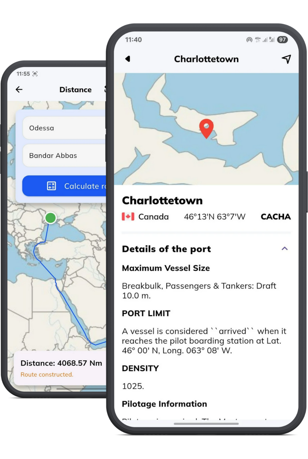
Comprehensive Port Distances & Information
✔ Global Coverage – Data on ports worldwide, including services, facilities, and contact details.
✔ Regulatory Compliance – General reference information on port entry guidelines (unofficial, for awareness only).
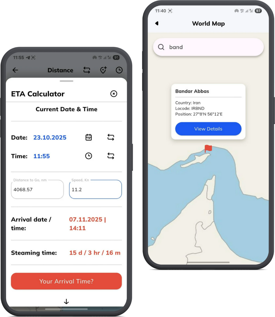
✔ Distance Calculation – Quickly estimate distances between ports.
✔ Graphical Route Display – View the suggested route on a world map for better voyage planning.
✔ Fuel & Time Estimation – Helps optimize speed, fuel consumption, and ETAs.
The Port Guide & Distances app is an indispensable tool for Captains, Navigators, and Shipping Companies, ensuring efficient and informed decision-making while navigating global waters.
Features and Benefits

Offline-Functionality
Access port details and calculate distances anytime, even without an internet connection

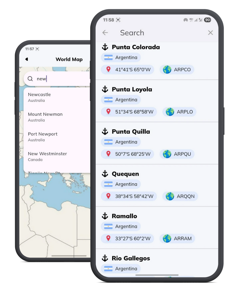
Global Port Database
Covers thousands of ports worldwide with up-to-date details

Route Calculation & Visualization
Instantly calculate distances and view routes on an interactive world map

Port Facilities Overview
Find crucial port information, including terminals, berthing options, and services

Navigation & Voyage Planning
Optimize routes for better fuel efficiency and time management

Intuitive & Easy to Use
Simple and intuitive design for quick access to information

Regulatory Information
Stay updated with port entry requirements and safety protocols

Essential for Ship Crew
Designed for captains, navigators, fleet managers, and shipping companies
Port Guide & Distances – Your Voyage Companion Anywhere
Mariners need fast, accurate, and reliable port information at all times. With Port Guide & Distances, you have a powerful offline resource that helps you plan voyages, estimate distances, and access vital port details anytime, anywhere.
📱 Optimized for mobile devices – Works seamlessly across all devices.
🔽 Quick installation required – Download and start using the app immediately.
⚡ Instant results – No complex setup, just input your ports and get accurate distances and routes.
🔹 For Captains & Navigators: Plan efficient routes, optimize fuel consumption, and ensure smooth port entries.
Save your time and effort with powerful features


